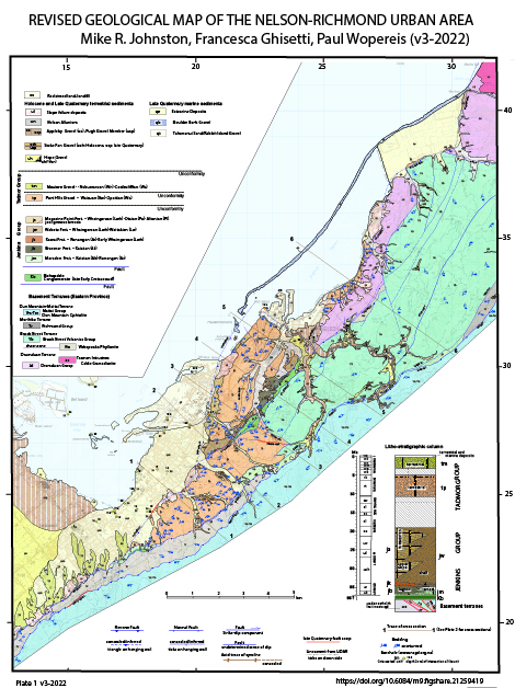
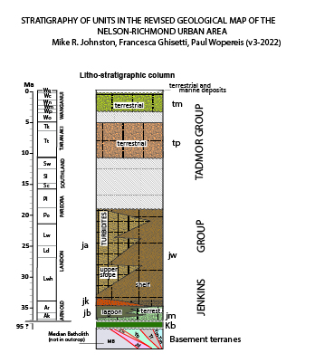
REVISED GEOLOGICAL MAP OF THE NELSON-RICHMOND URBAN AREA
M.R. Johnston, F. Ghisetti, P. Wopereis 2026
This page provides access to the geo-referenced (NZTM2000) "Revised Geological Map of the Nelson-Richmond Urban Area" by M.R. Johnston, F. Ghisetti and P. Wopereis (v4.2, 2026). This map updates the geology of the Neogene sedimentary units originaly mapped by Johnston (1979) in the "Geology of the Nelson Urban Area". The Johnston (1979 ) geological map and Illustrative notes provide details on the basement terranes in the Nelson-Richmond area and can be acquired from GNS .
The geological map and associated legend, stratigraphic column, cross sections, tectonic reconstructions and explanatory notes are freely available to download from this site for educational, scientific and non commercial purposes. A specific Disclaimer for users has been added to the map. The authors retain full copyright of all material posted here. Please use this reference link if sharing the material in any form.
Documentation
The following documents describe the structural setting and main faults of the Nelson-Richmond area.Download
A note on the main structures mapped in the "Revised Geological Map of the Nelson-Richmond Urban Area".
"
Download
A note on the role of mechanical weakness and fluid overpressure in controlling fault activity in the Nelson region and eastern margin of Tasma Bay.
Download
An explanatory note on the evolution of the Waimea-Flaxmore Fault System, as illustrated in the video that can be downloaded to the right.
Download
The video showing the evolution of the Waimea-Flaxmore Fault system, as reconstructed from 65 Million Years ago (Eocene) to the Present-day.
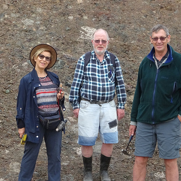
Photo Gallery
The following photographs show aspects of major active faults in the urban areaDisclaimer
This map and associated cross sections show an interpretation based on the geological mapping of the compilers and others, and is supplemented by limited subsurface data. Because of scale limitations and/or poor or no exposure some boundaries are not precisely located and the position of inferred or concealed features and faults is approximate. Some features have been omitted, including some slope wash, slope failures and other superficial deposits. The areal extent of some geological units has been enlarged to allow portrayal on the map.
This map and cross sections must not be used for building site assessment, engineering projects and development, and/or other work where site-specific investigation from geotechnical professionals is required.
It is aim of the compilers of this map to update it at periodic intervals as new information becomes available. This will likely lead to the refinement of the position of geological contacts and faults and the description of rock units depicted on the map. Any additional information related to the geological map and its interpretation is welcomed.